1799
PAYNE
20 x 25 cm
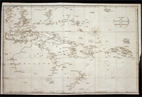
"A Chart Shewing the tract of Capt Cook’s last voyage 1799", by Low. The map shows the route of Cook’s third voyage around the Pacific rim in search of the fabled Northwest passage. On the…[more]
1799
WILSON, James, CHAPMAN, T
53 x 34 cm
This detailed chart shows the voyage of the Duff in 1797. This map marks and details the route of the first English missionary voyage to the Pacific. Captain James Wilson during the voyage also…[more]


.jpg)
