


Contact: contact@AntiqueMapArt.com, Phone: +61 (07) 3103 0391, Mobile: 0011 6723 51512 (Norfolk Mobile)

1581 - Die Eigentliche und Warhafftige Gestalt der Erden Und des Meers
| Map maker | Size | Map ID | Condition |
| Heinrich Bunting | 360 x 270 mm | D2 / M128 / I49 | Please contact us for the condition report |
| Ask about this item | | SOLD |
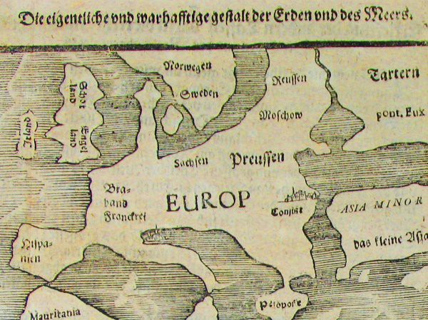
Map of the world showing a landmass remarkably like the west coast of Australia and roughly where Australia should be.
Bunting's map charts a landmass named 'India Meridionalis', which strikingly resembles Australia's west coast. Shown to be in roughly the correct position of Australia, its presence is thought by some to indicate the possible Portuguese knowledge of Australia, prior to the Dutch discovery in 1606. Given the general inaccuracy of the rest of the map, such an assertion should be made with some caution.
The map is rather crudely drawn, most of the shapes of the continents being fairly rudimentary, nevertheless the map remains a favourite amongst collectors. An early representation of America is shown and the Caspian Sea is greatly exaggerated in size.
The Mediterranean Sea is linked to the Black Sea by a waterway that extends all the way through Europe, presumably to the Arctic. Taprobana (Ceylon) is labelled but no landmass is charted. The seas are adorned with sea monsters and many major cities are indicated and named.
This information is adopted from the Printed World catalogue series, one of the most enjoyable and informative Australian Antique map catalogues available, created and compiled by Simon Dewez.
View map online on http://www.antiquemapart.com/map/128