Contact: contact@AntiqueMapArt.com, Phone: +61 (07) 3103 0391, Mobile: 0011 6723 51512 (Norfolk Mobile)

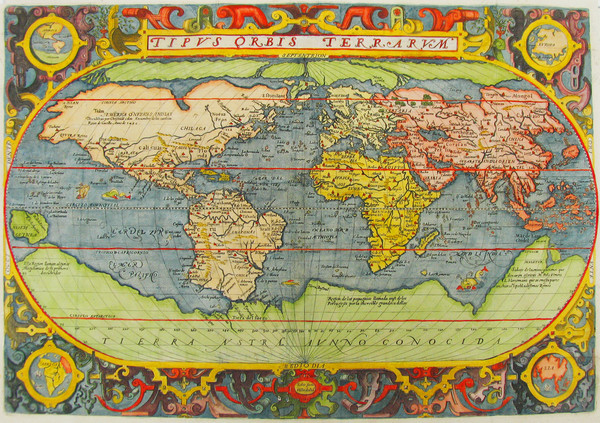
1603 - Tipus Orbis Terrarum
| Map maker | Size | Map ID | Condition |
| Fernando de Solis | 500 x 340 mm | D2 / M133 / I53 | Fine condition, coloured |
| Ask about this item | | SOLD |
Solis' map is one of the few world maps to be printed in Spain in the late 16 th and early 17 th centuries. Spain had a strict secrecy policy in connection with the production of maps relating to dominions outside of Spain . Portugal also implemented such a policy and hence very few printed maps from either country were produced and are therefore of considerable rarity. The medallions in each corner contain maps of the four known continents at the time.
Geographically, Solis' map follows closely Ortelius' famous world map of 1570. America still retains the bulge in the south, not found in later editions of Ortelius' map.
The obvious influence of Ortelius, and the fact that a companion map of America in the same book is dated 1589, lends support to Shirley and Barron's assertion that the engraving of the map was made in 1589.
A fine coloured copy of this superb world map published in Botero's rare geographical and political commentary.
This information is adopted from the Printed World catalogue series, one of the most enjoyable and informative Australian Antique map catalogues available, created and compiled by Simon Dewez.
View map online on http://www.antiquemapart.com/map/133
