Contact: contact@AntiqueMapArt.com, Phone: +61 (07) 3103 0391, Mobile: 0011 6723 51512 (Norfolk Mobile)

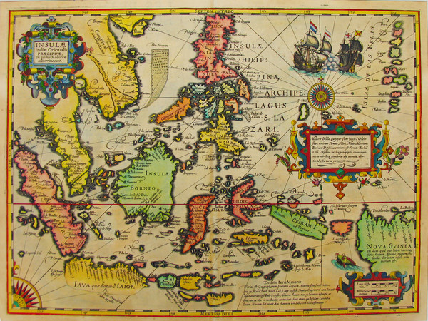
1606 - Insulae Indiae Orientalis Praecipuae. Molluae...
| Map maker | Size | Map ID | Condition |
| Gerard Mercator | 480 x 350 mm | D2 / M134 / I54 | Very good condition, some minor foxing, and minor stress along central fold. |
| Ask about this item | | SOLD |
Important map of Southeast Asia and one of the few to show evidence of Drake's contact with Java.
Gerard Mercator is, apart from Ptolemy, probably the most important of all cartographers. He was the first to produce maps on Mercator projection, aptly named after him. His most famous work Atlas, the first use of the term when describing a collection of maps, was published in three parts over several years. In 1604, Jodocus Hondius bought the plates from Mercator's son Rumold and expanded the number of maps, producing editions of Mercator's atlas from 1606 until the early 1630s. This map of Southeast Asia is one of the new additions that Hondius made for his 1606 edition of the Mercator atlas.
At this time, the Dutch East India Company (V.O.C.) was just emerging as a force to be reckoned with in the East Indies , challenging the Portuguese stronghold there. The rising tension between the two nations is clearly indicated on Hondius' map by a vignette showing a Portuguese and Dutch ship engaging in battle.
This information is adopted from the Printed World catalogue series, one of the most enjoyable and informative Australian Antique map catalogues available, created and compiled by Simon Dewez.
View map online on http://www.antiquemapart.com/map/134
