Contact: contact@AntiqueMapArt.com, Phone: +61 (07) 3103 0391, Mobile: 0011 6723 51512 (Norfolk Mobile)

May not depict actual map.
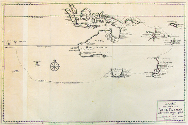
1726 - Kaart Der Reyse van Abel Tasman
| Map maker | Size | Map ID | Condition |
| Francois Valentyn | 470 x 305 mm | D1 / M153 / I325 |
| Ask about this item | | SOLD |
This map is included with Volumes 1 to 4 of Valentyn's rare work printed between 1724 and 1726. The map shows the track of Tasman's epic first voyage to Australia in 1642-43.
Also charted are the results of Tasman's second voyage discoveries in northern Australia in 1644, although the track of the second voyage in the Arnhem is not shown. Tasman was instructed to investigate the existence or otherwise of a passage between New Guinea and the Southland and although he failed to accomplish this, he did manage to chart much of the North Australia coastline.
Valentyn's monumental travel books, where this map comes from, contained amongst other things the first complete and accurate account of Tasman's two voyages to Australia .
Abel Tasman's two voyages to Australia in 1642-43 and in 1644, was the culmination of a series of Dutch landings on Australia 's shoreline.
For the 35 years following the first recorded landing on Australian soil by the Dutchman Jansz in 1606, the progressive discovery and subsequent charting of Australia 's western, southern and northern coastlines was an entirely Dutch affair.
Finally in 1642, Tasman was chosen to command a voyage of discovery intended to investigate those lands still unexplored by the Dutch, south of New Guinea . In the process, Tasman discovered Tasmania and New Zealand and effectively, albeit unknowingly, became the first person to circumnavigate Australia .
The Dutch were not entirely happy with what Tasman had achieved, believing he could have investigated more thoroughly those lands he had discovered. As a result, a second voyage was planned only some five months after the first voyage had arrived back in Batavia . This time Tasman was handed far more specific instructions. The Dutch were leaving little to chance and were keen to completely investigate the Southland.
This information is adopted from the Printed World catalogue series, one of the most enjoyable and informative Australian Antique map catalogues available, created and compiled by Simon Dewez.
View map online on http://www.antiquemapart.com/map/153
