


Contact: contact@AntiqueMapArt.com, Phone: +61 (07) 3103 0391, Mobile: 0011 6723 51512 (Norfolk Mobile)
.jpg)
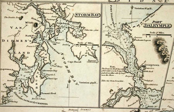
1837 - A Chart of Part of New South Wales, Van Diemens Land, New Zealand and Adjacent Islands, with the principal harbours
| Map maker | Size | Map ID | Condition |
| John William Norie | 930 x 635 mm | D1 / M214 / I127 | Good condition for a used sea chart. Appears to have several small compass holes and errased pencil notes. A used example of Norie's chart. |
| Ask about this item |
The large sea chart by Norie details the region between the southern part of Australia and New Zealand. At this time New Zealand was beginning to be colonised and this chart was most likely commonly used during the period. The map shows inset maps of a number of harbours including Port Jackson, storm Bay and Port Dalrymple.
The chart indicates that it was frst published in 1819 though it has been updated to 1837. A very impressive piece of Australian and New Zealand maritime settlement history.
View map online on http://www.antiquemapart.com/map/214