Contact: contact@AntiqueMapArt.com, Phone: +61 (07) 3103 0391, Mobile: 0011 6723 51512 (Norfolk Mobile)

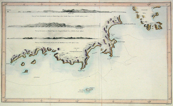
1784 - Chart of Van Diemen's Land
| Map maker | Size | Map ID | Condition |
|
James Cook
William Bligh | 350 x 220 mm | D1 / M230 / I146 | Original fold as issued. Good margins. |
| Ask about this item |
James Cook & William Bligh's map of part of the southern coast of Tasmania, formely Van Diemen's land. The charting was carried out during Cook's third voyage during which he was killed in Hawaii in 1779. His account of the third voyage was published five years after his death in 1784 , and included this chart.
View map online on http://www.antiquemapart.com/map/230
