Contact: contact@AntiqueMapArt.com, Phone: +61 (07) 3103 0391, Mobile: 0011 6723 51512 (Norfolk Mobile)
.jpg)
1790 - A Collection of Voyages round the World: Performed by Royal Authority. Containing a complete Historical Account of Captain Cook's First, Second, Third and Last Voyages…
| Map maker | Size | Map ID | Condition |
|
James Cook
George William Anderson | 130 x 210 mm | D1 / M264 / I193 | See below otherwise please contact us. |
| Ask about this item |
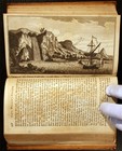
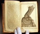
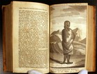
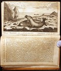
A Collection of Voyages round the World; Performed by Royal Authority. Containing a complete Historical Account of Captain Cooks's First, Second, Third and Last Voyages, undertaken For making New Discoveries, &c. … London: Printed for A. Millar, W. Law, and R. Crater 1790. 6 volumes Hardcover Good +/No Dust jackets. . Statement below frontispiece portrait of Capt. Cook, Vol. I, reads: "Published by Alex.r Hogg at the Kings Armes No 16 Paternoster Row, Jan 16, 1786." 132 full-page copperplate engravings and 28 folding maps. Continuous pagination of 2242 pp., plus 4 pages of Directions to the Binder at end.
Octavo volumes, 8" x 5" in brown leather with red panels and gilt lettering to the spines. Covers have scratches and dents, some stains, and wear to edges and corners; spines similarly worn especially at extremities. Bindings are firm except as noted for individual volumes below, the endpapers typically showing light cracks along the gutters. No bookplates or inscriptions; one signature, first blank page, Vol. VI; small pencil note indicating number of maps on front endpaper of each volume.
Page contents are aged toned to varying degrees, the plates often showing darkened areas, but the majority of text pages without foxing spots or stains, except as noted. Corner creases are the exception rather than the rule. The foldout maps and charts typically have creases from being re-folded, and one or two small tears, 1/4" - 1/2" along edges - larger tears are individually noted.
Significant physical flaws for the entire set can be summarized as follows: two loose front covers, portion missing from one foldout map; one page with hole in center of text area, last four pages missing from Vol. I; 7 of the plates absent or removed. Specific conditions and notes for each volume are given below.
Volume I: Front board cracked away from binding, attached by one cord. 1 1/2" tear to top of front endpaper, 1 1/2" tape mended tear, bottom edge of first blank page. Plate "General Chart", p. 9, is absent; foldout, "Chart of Island near Otahatie," p. 48, tape mended to repair separation; plate, "Island of Huaheine," p. 107, is absent; foldout "Chart of Cook's Straits," p. 164 has small tape mend to 2" tear at bottom edge; plate "Animal, called Kinguroo," p. 191 has 1/2" curved, attached tear within the illustration; pp. 369 - 372 are absent, p. 368 being followed by the last blank page and rear endpaper, without signs that the missing pages were once present and later removed.
Volume II: pages 465 - 472 are incorrectly inserted between p. 392 and 393; plate, "North East View, Otahatie," p. 181, is absent; foldout, "Chart of Matavia Bay," p. 182 neatly mended with paper strips on back to repair horizontal tear, with additional 1 " tear to right edge into map area; plate "Captain Cook landing at Tanna," p. 605 is loose from binding; plate "View of the Island of New Caladonia," p. 639 has been removed; portion missing from foldout "Chart of Terra del Fuego," p. 679 [see photo detail].
Volume III: frontispiece "Possession Bay," has been removed; this volume has several groups of pages affected by foxing, notably pp. 873 - 882, pp. 931 - 946, and pp. 1071 - 1112; a number of the plates have areas of brown stain affecting the pages immediately adjacent, particularly those opposite p. 874, 916, 960, and 992; plate, "Natives of Otahaite, &c.," p. 986, is absent; the five maps (not 4, as noted on the endpaper) are all present and in good condition.
Volume IV: foldout "Map of Kerguelen's Land," p. 1267, has 3" tear along fold line, lower edge; foldout "View and Plan of Adventure Bay," p. 1289 has 1 1/4" tear to right edge; p. 1323 has 3" diagonal attached tear to lower corner; foldout, "Man of Mangea, &c.," has 4" irregular tear into left edge and 2" straight tear along fold, bottom edge; plate "Captain Cook at Hapaee," p. 1387, is absent; foldout, "Tongataboo Harbour," p. 1445 has 3/4" oval brown stain within map area; foldout, "Friendly Islands," p. 1472 has 2" irregular tear to right edge; foxing spot, upper margin, pp. 1508 - 1522; small chip missing from bottom corner of p. 1535.
Volume V: front cover separating, attached by two cords; top front corner heavily bumped; damp stains on front endpaper and blank pages, visible as line along top edge of some but not all pages in roughly first half of book; p. 1655 has 1/2" x 2" chip missing at the lower corner, with loss of a few text letters; 1 1/2" x 2" oval hole, p. 1767, with 2 1/2" x 3 1/2" corresponding stains to the two adjacent plates [see photo detail]; plate, "An Indian of the southern parts of California…," p. 1775, has been trimmed with loss of the lower line of the title; plate, "An Offering before Captain Cook…," p. 1809 (listed as being opposite p. 1936 in Vol. VI in the "Directions to the Binder") is missing a small chip from the left page edge, and has a 1 1/2" tear into the left edge, both outside the illustration; p. 1939 has 1/2" oval hole in lower page area, well outside text.
Volume VI: plate, "Death of Captain Cook, p. 1969, is a plate rather than a foldout, as indicated in the "Directions"; p. 4 of the Directions to the Binder, has a 1" square area affected by attached tears, with some small loss of the paper, but text still legible.
View map online on http://www.antiquemapart.com/map/264


