Contact: contact@AntiqueMapArt.com, Phone: +61 (07) 3103 0391, Mobile: 0011 6723 51512 (Norfolk Mobile)

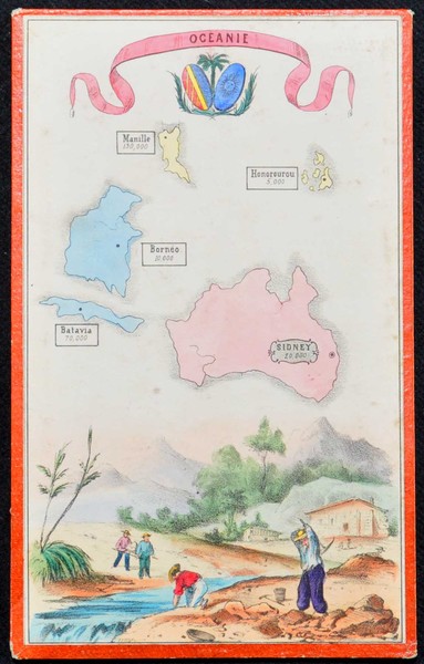
1855 - Oceanie
| Map maker | Size | Map ID | Condition |
| Anonymous | 135 x 215 mm | D1 / M318 / I284 | Very good condition. |
| Ask about this item | | SOLD |
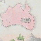
This interesting small map was most likely part of a board game or some other game or set. It shows several Pacific Islands and Australia. On each is marked the population of its major city/town. Interestingly the map notes that Sydney’s population is 20,000. This would date it to around 1810, which would also be supported by the map of Australia not showing Spencers Gulf (added in 1814). However the map appears to show a scene from the Gold Rushes (beginning in 1851), which would date it to the 1850s. We have taken this opinion dating it as c1855.
As it was most likely used for some form of game the map has little accuracy apart from the basic shapes of the landmasses. Under the maps is a scene most likely of the Australian Gold Rushes showing a man gold panning and another using a pick. A gold pan can be seen in the foreground. The map is hand coloured and mounted onto board. We currently have no record of another copy of this map.
View map online on http://www.antiquemapart.com/map/318


