


Contact: contact@AntiqueMapArt.com, Phone: +61 (07) 3103 0391, Mobile: 0011 6723 51512 (Norfolk Mobile)
.jpg)
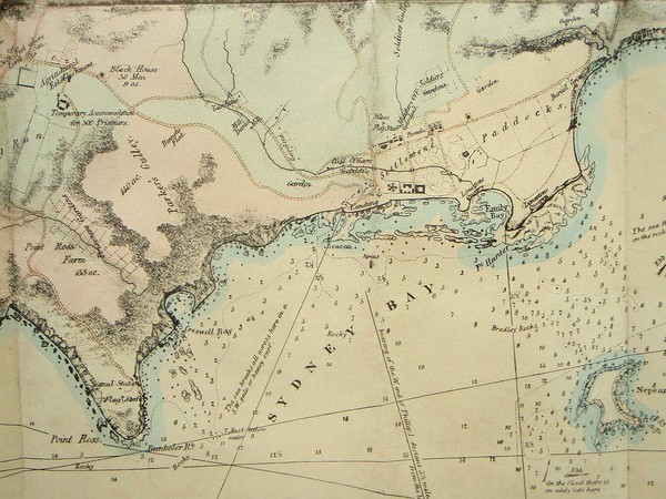
1841 - Plan of Norfolk Island shewing the general nature of the ground
| Map maker | Size | Map ID | Condition |
| John Arrowsmith | 590 x 450 mm | D1 / M335 / I303 | Very good condition. Please contact us for a full condition report |
| Ask about this item | | SOLD |
A rare map of Norfolk Island drawn to accompany Majr. Barney's letter to the Hon.bl The Colonial Secy. Dated 20th Feby. 1840. Maps of the island are rare to find and especially pieces printed during the island's second settlement (1825 to 1856).
The map shows the island topography and also the location of buildings, farms, prisons, gardens, etc on the island. The map was part of the material produced to show how convicts in Australia/Tasmania/Norfolk Island were being treated.
View map online on http://www.antiquemapart.com/map/335