Contact: contact@AntiqueMapArt.com, Phone: +61 (07) 3103 0391, Mobile: 0011 6723 51512 (Norfolk Mobile)

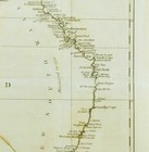
1787 - A New Chart of New Holland on which are delineated New South Wales, and a plan of Botany Bay
| Map maker | Size | Map ID | Condition |
| J. Andrews | 353 x 360 mm | D1 / M350 / I322 | Please contact us for a detailed condition report |
| Ask about this item | | SOLD |
An exceptional chart of Australia and one of the very few pre settlement maps that focus exclusively on the Australian continent. This rare piece was included in the important book "The history of New Holland" published in 1787 that detailed the history and known facts about the Australian continent as well as the plans of the First Fleet and the proposed settlement to be established in Botany Bay.
Australia (New Holland) is still very much a mis-match jigsaw of early discoveries correlated together. Tasmania (Van Diemens Land) is shown connected to the mainland and the Southern parts of Australia do not show the presence of Spencers Gulf. The east coast now called New South Wales has many place names, which come directly from Cook’s chart published in 1773, being the most detailed survey of the landmass carried out to that point.
A very desirable and increasingly rare map that is essential to any collection that focuses on Australia.
View map online on http://www.antiquemapart.com/map/350


