Contact: contact@AntiqueMapArt.com, Phone: +61 (07) 3103 0391, Mobile: 0011 6723 51512 (Norfolk Mobile)

1925 - The Indicator MAP OF SYDNEY
| Map maker | Size | Map ID | Condition |
| Kenneth Craigie | 315 x 250 mm | D1 / M380 / I355 | Some rust staining on map from metal indicator, which also has some rust. Very minor soiling, no tears, several small pin holes. |
| Ask about this item | | SOLD |
The indicator map of Sydney is a very interesting piece of pre-depression Sydney Ephemera. The early street finder is focused on central Sydney, 1.5 miles from Central Railway Station in all directions. It notes that it allows the user to find "over 1300 Streets, Parks, Buildings, etc...". The instructions on the map reads the following, "Instructions for use- To find any street refer to Index for Guide Number and Letter, turn Metal Indicator to number on Map, and street will be found opposite letter on Indicator. The nearest Tram Route is shewn on Map. Distances from any given point can be ascertained from on the right hand side, even on the left; on the cross streets the numbers start from the west, odd and even Numbers as above."
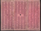
The map has 60 numbers around its outside, which is a 3 mile circle of Sydney. The Metal indicator has the letters on it and also distance, which can be easily moved, pivoting from its central fixed point. The map is marked with the printed price of 3 shillings and on the bottom of the map states "Sold on Behalf of the Women's Hospital, Crown Street, Sydney". On the back of the map is stiff red cloth that has the index to streets marked on it. The map does not show St James station, which was not opened until 1928.
View map online on http://www.antiquemapart.com/map/380
.jpg)
.jpg)

_1.jpg)
.jpg)

