Contact: contact@AntiqueMapArt.com, Phone: +61 (07) 3103 0391, Mobile: 0011 6723 51512 (Norfolk Mobile)

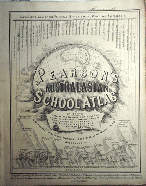
1867 - Pearson's Australasian School Atlas
| Map maker | Size | Map ID | Condition |
| J.W Pearson | 250 x 305 mm | D1 / M382 / I358 | Good condition. Please contact us for a full condition report |
| Ask about this item | | SOLD |
Pearson's rare school atlas is one of the first atlases printed in Australia. The atlas was printed in Melbourne in 1867 and is noted in the publishers' preference that other school atlases available at the time were often out of date, stating "in an atlas now in use in our Schools, the map of Australasia is divided into four parts, viz, New South Wales, South Australia, Western Australia, and North Australia; whilst the colonies of Victoria and Queensland are wholly omitted". During our research on the atlas we found a review of it from a New Zealand newspaper called the West Coast Times from November 6th 1867 stating "Pearson's Australasian School Atlas is a handy-book of delineated geography that will prove most serviceable in school teaching, and most interesting and valuable to all classes for reference".
The atlas contains ten hand coloured maps being the east and west hemisphere, Australasia, Victoria, New South Wales, South Australia, Tasmania, Queensland, New Zealand, and the routes of the explorers (up until 1867). The title page also displays the “comparative view of the principal rivers in the world and Australasia” and “ comparative view of the principal mountains in the world and Australasia”. At the bottom of the page it notes “Sold by all booksellers in the Australian colonies. Price plain in stiff covers 1/6, coloured 2/, library edition 3/6, in cloth lettered and fine paper”. This is the first edition of the library edition.
View map online on http://www.antiquemapart.com/map/382


