Contact: contact@AntiqueMapArt.com, Phone: +61 (07) 3103 0391, Mobile: 0011 6723 51512 (Norfolk Mobile)
_0.jpg)
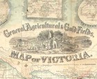
1859 - General, Agricultural & Goldfields, MAP of VICTORIA
| Map maker | Size | Map ID | Condition |
| Frederick Proeschel | 460 x 520 mm | D1 / M383 / I359 | The map has a number of manuscript markings and place names underlined. Some small points of loss mostly on cross folds. Please contact us for a full condition report. |
| Ask about this item | | SOLD |
An exceptional, beautiful, interesting and very rare map of Victoria, which is most well known for its detailed central vignette of a goldfields scene showing a man holding a flag and at his feet an Emu and Kangaroo either side of the colonial Australian crest. On one side of the engraving are scenes from one of the Victorian goldfields showing the varied kind of work carried out. On the other side is an agricultural scene with an aboriginal man resting in the grass. There are two other images in both of the top corners, one being the New Treasury in Melbourne and the other of the Town Hall in Geelong.
Below the map are statistical tables showing a host of different information concerning the Victorian Colony. This includes population size, Exports of Victoria, Imports of Victoria, Gold production. Most interestingly much of this information is compared with other regions of the world such as Great Britain, The United States, and European countries so that the reader is aware of the relative success of the colony. At the bottom of the map is stated “The above tables show that of all the principal civilized countries in the world, Victoria has per head the greatest value of export and is the greatest consumer of British products”.
Proeschel’s map of Victoria also shows finished and proposed railways, electric telegraph, mail roads travelled, and mining districts. The map is mounted onto linen and folds into a booklet of hard green cloth with “Proeschel’s Most Complete Desk & Travellers Map of Victoria” embossed in gold on it. Also in the booklet are several pages of information, the first of which advertisers Henry Jackson a Gold broker amongst other things. The subsequent pages note Hotels in Melbourne, Sandhurst, Maldon, Geelong, Ballaarat. The final pages list Merchants and Other Businesses in these areas including also Queenscliff. It is difficult to know if there are pages missing and if so how many as the pages are not numbered and no other identical copy is known to us. Some examples of the map that have been found include an index of towns, features and regions of Victoria that can be found using the maps grid reference.
Proeschel was born in France in 1809 and moved out to Victoria to participate in the gold rushes in 1852. Basing himself in Melbourne he set about producing maps of routes to the goldfields as well as general maps of Victoria and Melbourne. Proeschel was the only private map publisher in Victoria at the time and so was able to produce a varied collection of work compared with what was available. In May 1860 he became a member of the Royal society of Victoria. By 1863 he produced his famous "Atlas of Australasia", though it is believed that he was unlikely to have recouped his sizeable £3000 investment in its publication, even though it received much acclaim. He left Australia in 1864 and after pursuing a few opportunities settled again in France before his death in 1870 leaving an estate of a mere 40 francs.
View map online on http://www.antiquemapart.com/map/383


