Contact: contact@AntiqueMapArt.com, Phone: +61 (07) 3103 0391, Mobile: 0011 6723 51512 (Norfolk Mobile)

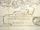
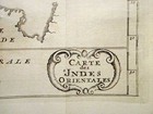
1703 - Carte des Indes Orientales
| Map maker | Size | Map ID | Condition |
| William Dampier | 280 x 155 mm | D1 / M75 / I362 | Good condition |
| Ask about this item |
Dampier, a reformed pirate, published an account of his buccaneering voyages in 1698, gaining himself a better reputation. Dampier travelled to Australia on two occasions, once in 1688 on Read's ship, the Cygnet and again some 11 years later on the Roebuck. He got the command of HMS Roebuck on an expedition to explore Australia, which set out in 1698. He anchored in Shark's Bay in August 1699 but was unable to find any fresh water or provisions. With his crew suffering from scurvy he left Australia for Timor, then sailed to New Guinea, finding and naming New Britain, as marked on this map. The low morale and poor condition of his ship made Dampier turn for home, after re-provisioning in Batavia. Having passed the Cape of Good Hope his ship sprang a leak, but it managed to reach Ascension Island, where it was beached and abandoned. His crew was stuck on the desolate island until they were picked up by a home-bound fleet.
This map shows the voyage of the Cygnet in 1688 and comes from a French edition of 'A New Voyage around the World'.
View map online on http://www.antiquemapart.com/map/75


