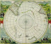
One of the earliest polar maps of the Antarctic.
Of particular interest to historians is the suggestion in the text accompanying this map, which describes rather accurately the…[more]
One of the earliest polar maps of the Antarctic.
Of particular interest to historians is the suggestion in the text accompanying this map, which describes rather accurately the…[more]
Up until 1627, the knowledge of Australian coastlines was restricted to largely haphazard contacts and sightings on the western and northern coasts. The eastern and southern coasts were completely…[more]
Up until 1627, the knowledge of Australian coastlines was restricted to largely haphazard contacts and sightings on the western and northern coasts. The eastern and southern coasts were completely…[more]
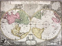
The 'Nova Totius Terrarum Orbis Tabula' reworked by Rossi from De Wit's wall map. It is a tremendous and beautiful world wall chart that was originally printed on 12 separate sheets, which were…[more]
The 'Nova Totius Terrarum Orbis Tabula' reworked by Rossi from De Wit's wall map. It is a tremendous and beautiful world wall chart that was originally printed on 12 separate sheets, which were…[more]
De Wits edition of this famous hemispherical map of the Antarctic region by Hondius. This edition shows the discoveries of Tasman in Australia and New Zealand .
Originally published by…[more]
Valck's map was made by the famous mapmaker Joan Blaeu. It is believed to have been engraved in 1672, but neverpublished. Historians assume that a great fire at Blaeu’s printery was the reason he…[more]
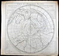
First edition of De lisle's polar hemispherical map showing Australia and New Zealand according to Tasman's two voyages in 1642-3 and 1644.
This is the first state of De l'isle's…[more]
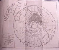
A very interesting map of the southern hemisphere focusing on the southern pole and Australia. This is the English edition of Buache's map which theorizes on the shape of the Antartic landmass.…[more]
A very interesting map of the southern hemisphere focusing on the southern pole and Australia. This is the English edition of Buache's map which theorizes on the shape of the Antartic landmass.…[more]
Cooks map of the Southern Hemisphere after his second voyage. The map was the key chart of his second voyage, which was published in 1777. The map dispells the myth of the great southern land. It…[more]
A French edtion of Captain James Cook's famous chart of the Southern Hemisphere. The original English edition was printed in 1777 when Cook's second voyage was published. The French edition was…[more]
A French edtion of Captain James Cook's famous chart of the Southern Hemisphere. The original English edition was printed in 1777 when Cook's second voyage was published. The French edition was…[more]
This map of the southern hemisphere by Bonne is one of 4 that show the North, South, East, and West…[more]
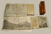
The third edition of Cook's famous voyage in which the East Coast of Australia and most of New Zealand was discovered and charted. There are 4 volumes in total in an octavo format. Unlike the…[more]
A small chart of the southern hemisphere that shows the track of HMS Sirius on her voyage out from England in 1787 as the flagship to the First Fleet. The First Fleet was made up of eleven ships…[more]


.jpg)



.jpg)