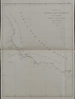
These 7 views of the coastline between Cape Leeuwin in Western Australia to Cape Wiles in South Australia are an interesting and important relic from Flinders famous journey during the…[more]
Pearson's rare school atlas is one of the first atlases printed in Australia. The atlas was printed in Melbourne in 1867 and is noted in the publishers' preference that other school atlases…[more]
Here on offer are two (2) important and interesting books on the early years of Australian settlement. These two volumes are 'The History of New South Wales, including Botany Bay, Port Jackson,…[more]
This very interesting map charts the voyage of William Bligh after he was set adrift during the Mutiny on the Bounty in 1789. He would then sail over 6000kms from Tofoa (Tonga) to Bativa…[more]
These 7 views of the coastline between Cape Catastrophe in South Australia to Cape Schanck in Victoria are an interesting and important relic from Flinders famous journey during the…[more]
Ortelius' famous atlas 'Theatrum Orbis Terrarum' was first published in 1570. Regarded as the first 'modern' atlas, it comprised maps of similar size and style. It wasn't until the 1590 edition…[more]
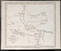
An unusual depiction of the Australian continent upside down. Hunter's map of Australia illustrates the voyage of the Waaksamheyd, a dutch vessel, that was used to transport the wrecked crew from…[more]
In 1805 when this map was printed there was a strong belief that the Australian continent may be divided by an internal sea so that the east coast was separated from the rest of the …[more]
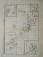
Bonne's chart of New Zealand is among the first maps produced of the Islands, being a representation of Cook's 1773 charts. Bonne essentially copied a number of Cook's charts for his atlas and…[more]
The large sea chart by Norie details the region between the southern part of Australia and New Zealand. At this time New Zealand was beginning to be colonised and this chart was most likely…[more]
A map by Tobias Lotter, whose family produced a considerable amount of cartographic material in the 18 th century. This piece though damaged illustrates an example of one of the last decorative…[more]
Reference image of an earlier edition held by the National Library. We hope to have an image of our example shortly.
Arrowsmith's impressive engraved map of Australia issued originally…[more]
Believed by many to be the first published chart of the Pacific to show Australia 's east coast and both the north and south islands of New Zealand . Cook's first voyage track is charted.
…[more]Wyld's large size map of Australia was one of the first in a series that would show the progress of exploration on the continent. The earliest edition of this map is believed printed in 1833 that…[more]
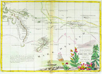
Map of Australia , New Zealand , New Guinea and the South Pacific. One of the earliest maps to show the tracks of the voyages of Capt. Cook, Carteret, Byron, Wallis and Mouats.
Zatta's…[more]
Oxley's chart of Port Macquarie and part of the course of the Hastings River for about 17 miles upstream including depth soundings. Initially it was thought that the Hastings would be ideal for…[more]
This very rare first edition Flinders chart depicts the region of coast between Melbourne and Adelaide. We will provide a more detailed and in depth description of the map soon.
We have…[more]
Focusing on Oxley's route during his second expedition through the central part of New South Wales along the Macquarie river. From the Macquarie Marshes it continues eastwards across the western…[more]
One of the few 18 th century maps concentrating on the Australian continent and showing the east coast joined from New Guinea to Tasmania .
This chart of Australia exemplifies French…[more]


.jpg)
.jpg)
.jpg)


.jpg)
.jpg)
.jpg)
 IH53.jpg)
.jpg)
