Printed from www.AntiqueMapart.com Catalogue on Saturday, Nov 23 2024
Search Criteria:


Showing Maps 41 to 49 of 49Jump to Page:Next123
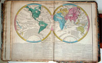
Mappe-Mondes sur Diverse Projections
1812
CHAMOUIN, MALTE-BRUN, Conrad
46 x 33 cm

This interesting world map comes from Malte-Brun and Lapie's decorative atlas of 1812. Though this map is often shown to have been first printed in 1805 it is very unlikely as it shows…[more]

Erd Charte nach der Bonneschen Projection...
1814
KELLER, Heinrich
100 x 60 cm

A beautiful large world map by Austrian mapmaker Heinrich Keller. Interestingly as this map was printed early in 1814 the detail of Australia shows a pre Flinders Australia with the French claim…[more]

Le Sage's Historical, Genealogical, Chronological and Geographical Atlas…
1818
LE SAGE
39 x 51 cm

The English edition of Le Sage's impressive French folio atlas. This is the second English edition and is updated until 1818. Its title page notes "Second Edition improved with a new Geographical…[more]

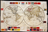
MappeMonde Revue et Corrigee
1820
ANONYMOUS
40 x 26 cm

An early world map from 1820 displaying a number of National flags. It is interesting to see how many flags have since changed their design, though the Union Jack is still much as it was in…[more]

Lavoisne's Complete Genealogical, Historical, Chronological, and Geographical Atlas…
1822
LAVOISNE
30 x 45 cm

information to…[more]

Mappemonde
Mappemonde
1836
MALTE-BRUN, Conrad
48 x 27 cm
Information to…[more]
The World in Hemispheres, with comparitive views of the heights of the principal Mountains and lengths of the principal Rivers on the Globe.
1844
JOHNSTON, A.K
65 x 53 cm

A brilliant later world map that also shows the comparitive heights of the highest mountains and lengths of the longest rivers. From Johnston's 'National Atlas' the map is a fine example of his…[more]

The world on Mercator's Projection
1862
RAPKIN, J.
35 x 26 cm

This map of the world with decorative border was updated and modified from Rapkin's original series of maps featured in Tallis' famous 1851 atlas publication and associated…[more]

Räths Physikalischer Erdglobus ; 1:38 600 000
1950
RÄTH, Paul
34 x 52 cm

Rath's firm was located in Leipzig, Germany, a city known for its publishing houses. Rath established the firm in 1917 and from 1921 also produced electric illuminated globes. His globes from a…[more]