Oud en Nieuw Oost-Indiën...
1724 VALENTYN, Francois 30 x 22 cm Six parts of the Eight Volumes of Valentyn's (Valentijn) rare work printed between 1724 and 1726. More information to come. …[ more]
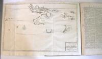
A General Chart of the Passage from England to Botany Bay in New Holland 1787
1787 ANDREWS, J. 39 x 26 cm Though this appears to be a map of the world it’s actual objective is to illustrate Australia’s (New Holland) distance from England and the track that is planned to be taken by the First Fleet on…[more]
The History of New Holland, from its First Discovery in 1616, to the Present Time… with a Particular Account of its Produce and Inhabitants; and a Description of Botany Bay...An Introductory Discourseon Banishment
1787 EDEN, STOCKDALE, J THE HISTORY OF NEW HOLLAND, from its First Discovery in 1616, to the Present Time. With a Particular Account of its Produce and Inhabitants; and a Description of Botany Bay: also, A List of the…[more]
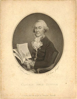
An Historical Journal of the Transactions at Port Jackson & Norfolk Island
1793 HUNTER, John 23 x 29 cm 4to. Complete with all called for engravings and charts. Information to…[more]
Views on the South Coast of Terra Australis. Plate XVII (8 to 14)
1814 WESTALL, William, FLINDERS, Matthew 48 x 72 cm These 7 views of the coastline between Cape Catastrophe in South Australia to Cape Schanck in Victoria are an interesting and important relic from Flinders famous journey during the…[more]
Views on the South Coast of Terra Australis. Plate XVII
1814 WESTALL, William, FLINDERS, Matthew 48 x 72 cm These 7 views of the coastline between Cape Leeuwin in Western Australia to Cape Wiles in South Australia are an interesting and important relic from Flinders famous journey during the…[more]
To the officers in the Honorable East India Company's service this outline chart...
1815 HEATHER, William, WALLIS, James 120 x 64 cm This rare chart by Heather belonged to Major (Captain) James Wallis of the 46th Regiment, who
was responsible for the early building of Newcastle (NSW) and also one of
the early artists to…[more]
Sydney Gazette and New South Wales Advertiser, March 31st 1827
1827 HOWE, Robert 40 x 54 cm The Sydney Gazette was Australia's first newspaper, beginning operation in 1803. The paper was founded by George Howe whose son Robert would eventually take control of the paper in 1821. Initially…[ more]
Sydney Gazette and New South Wales Advertiser, March 22nd 1827
1827 HOWE, Robert 40 x 54 cm The Sydney Gazette was Australia's first newspaper, beginning operation in 1803. The paper was founded by George Howe whose son Robert would eventually take control of the paper in 1821. Initially…[ more]
THE FRIEND OF AUSTRALIA; or, A Plan for Exploring the Interior, and for Carrying on a Survey of the Whole Continent of Australia...
1830 MASLEN, Thomas J 21 x 14 cm A very rare and desirable book on a plan to explore the interior of Australia by a retired officer. More information to come.…[more]
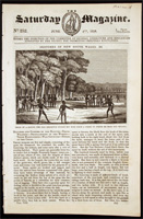
The Saturday Magazine, June 4th 1836: Sketches of New South Wales. III
1836 PARKER, John William 18 x 28 cm The Saturday Magazine was issued by the Committee of General Literature and Education, who were supported by the Society for Promoting Christian Knowledge. At this this time the expansion of the…[more]
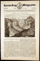
The Saturday Magazine, May 7th 1836: Sketches of New South Wales I
1836 PARKER, John William 18 x 28 cm The Saturday Magazine was issued by the Committee of General Literature and Education, who were supported by the Society for Promoting Christian Knowledge. At this this time the expansion of the…[more]
The Saturday Magazine, May 28th 1836: Sketches of New South II
1836 PARKER, John William 18 x 28 cm The Saturday Magazine was issued by the Committee of General Literature and Education, who were supported by the Society for Promoting Christian Knowledge. At this this time the expansion of the…[more]
Sydney Morning Herald, September 14th 1843
1843 FAIRFAX, John The Sydney Morning Herald was first founded in 1831 and was called the Sydney Herald. In 1841 it was purchased by John Fairfax who renamed it to its current title. The paper gradually increased its…[ more]
New South Wales and Van Diemens Land, Copies or extracts of any correspondance between the secretary of state…on the subject of Convict Discipline not already laid down before the house…
1846 COLONIAL OFFICE, MACONOCHIE, Alexander
Map of the suburban lands of the City of Melbourne
1852 AKERLAND, E., HAM, Thomas 50 x 80 cm Hams map of Melbourne is one of the earliest and best of the city. Victoria had only been officially proclaimed the year before and it shows Melbourne just before the boom of the gold rushes when…[more]
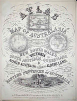
Proeschel's Atlas of Australasia
1863 PROESCHEL, Frederick Evidence continues to imerge that points to Proeschel's atlas being the first national atlas to be printed in Australia. William Baker did publish 'The Australian County Atlas' in Sydney in 1843,…[more]
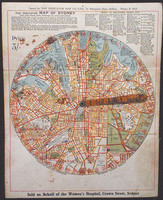
The Indicator MAP OF SYDNEY
1925 CRAIGIE, Kenneth 32 x 25 cm The indicator map of Sydney is a very interesting piece of pre-depression Sydney Ephemera. The early street finder is focused on central Sydney, 1.5 miles from Central Railway Station in all…[more] Last updated Wed Sep 11 12:19:15 AEST 2024 |


.jpg)
.jpg)
.jpg)




.jpg)
.jpg)
