The map focuses on Southern Asia and the Northern Pacific, also showing part of the west coast of North America. Part of northern Australia can be seen coloured in green at the bottom of the map.…[more]
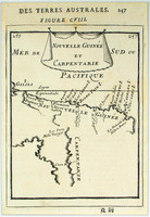
The first detailed published map to show any part of Queensland (Tully). Shows New Guinea , the east coast of Cape York Peninsula and part of Arnhem Land .
Although not a particularly…[more]
Tallis was best known for his very accurate and visually appealing maps and views, which included most of the countries and many of the colonies of the world at that time. His most accomplished…[more]
By the late 1840s the extent of exploration of the Australian continent had expanded dramatically. This map illustrates many of the newly explored regions not seen on Johnstons 1844 map of…[more]
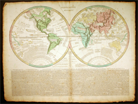
Le Sage's map of the world is a good example of the movement towards the information age where information was key to the importance of a map and placing it into context rather than its decorative…[more]
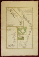
Bonne's map of Australia's east coast combines a number of James Cook's maps onto the one, in a kind of consolidation often used by Bonne. The map shows Australia's east coast, an inset of part of…[more]
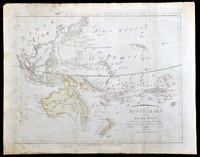
Sotzmann's map of the pacific is a popular German depiction of Australasia. Here Australia can be seen still connected to Tasmania as was believed until Flinder and Bass's discoveries in 1798…[more]
‘Isles de Salomon’, c1683 by Mallet. The map shows a number of ships exploring the Pacific. Interestingly the map hints at the possibility that New Zealand may be connected to the Solomon…[more]
The Alexander was one of the eleven ships that made up the first fleet which settled the English in Australia in January 1788. The 450- ton convict transport ship transported around 200 convicts…[more]
Map showing the Australian states very similar to how they are today. The map shows 68 counties in NSW. 38 in QLD, 24 in VIC, 14 in SA, and 26 in WA. Inset maps of both Tasmania and the…[more]
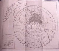
A very interesting map of the southern hemisphere focusing on the southern pole and Australia. This is the English edition of Buache's map which theorizes on the shape of the Antartic landmass.…[more]
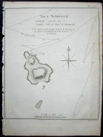
The first map of Norfolk Island, which was discovered in 1774. The first edition of this map was included in James Cook's second voyages published in 1777. Because of Cook’s voyages wide…[more]
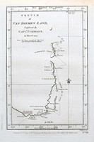
The first edition of the first separately printed English map to show part of the coast of Tasmania. Furneaux's track in the Adventure is shown.
In this English edition, this is the…[more]
The Scarborough was one of the ships of the First Fleet, which brought the English to Sydney in January 1788, where they would establish the first English settlement.
, .This chart shows…[more]


.jpg)
.jpg)
.jpg)
.jpg)
.jpg)

.jpg)
.jpg)

.jpg)
.jpg)
