In 1805 when this map was printed there was a strong belief that the Australian continent may be divided by an internal sea so that the east coast was separated from the rest of the …[more]
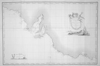
A plan of Adventure bay showing anchorage points from the expedition in 1793 and published in the D'Entrecasteaux atlas of 1807.…[more]
Here on offer are two (2) important and interesting books on the early years of Australian settlement. These two volumes are 'The History of New South Wales, including Botany Bay, Port Jackson,…[more]
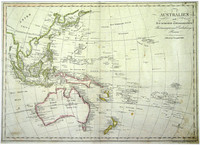
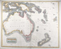
From the Viennese engraver Mollo. This map shows the popular depiction of the region including much of the South Pacific, South East Asia, New Zealand, and Australia. Australia is labeled "Neu…[more]
The first complete, published map of Australia.
Although Matthew Flinders was the first person to circumnavigate Australia, in Her Majesty’s ship the Investigator between 1801-03,…[more]
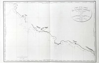
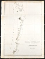
Chart by Freycinet showing Baudin's voyage of 1802 in which he charted the coastlines of Australia at the same time that Matthew Flinders was circumnavigating Australia. The chart is designed for…[more]
Only the second published, complete map of Australia and the first to name Flinders' discoveries.
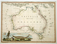
Lapie's fine map of Australia was published just one year after his fellow compatriot,…[more]
This interesting world map comes from Malte-Brun and Lapie's decorative atlas of 1812. Though this map is often shown to have been first printed in 1805 it is very unlikely as it shows…[more]
These 7 views of the coastline between Cape Leeuwin in Western Australia to Cape Wiles in South Australia are an interesting and important relic from Flinders famous journey during the…[more]
Offered here is the very rare and desirable first edition of Flinders exceptional and important chart, printed before the death of Flinders and before the admiralty would begin to publish the…[more]
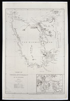
Flinders chart of Van Diemen's land from his first edition of the chart issued before the event of his death in the same year (1814). This example comes from the much rarer elephant folio that…[more]
In 1814 Matthew Flinders printed his account of his discovery and charting of the Southern coastlines of Australia shortly before he died. This map printed the same year as flinders’ is an…[more]
Blackwood's map of the Southern Pacific is based on James Cook's 1773 chart of the same area. In this case the map was produced to be included in "Kerrs collection of voyages and travels". As…[more]
A beautiful large world map by Austrian mapmaker Heinrich Keller. Interestingly as this map was printed early in 1814 the detail of Australia shows a pre Flinders Australia with the French claim…[more]
Offered here is the very rare and desirable first edition of Flinders exceptional and important chart, printed before the death of Flinders and before the admiralty would begin to publish the…[more]
Flinders' chart in his ship the 'Investigator' (1802) of the central/northern Queensland coast shows the region between Cape Manifold and Cape Grafton as charted by both Cook and Flinders.…[more]
The rare first edition chart by Matthew Flinders printed before the admiralty began publishing the chart. Shown is the Queensland coast between Wide Bay (near Noosa Heads) and the Flat Isles…[more]


.jpg)
.jpg)
.jpg)

.jpg)

.jpg)
.jpg)
.jpg)
.jpg)
