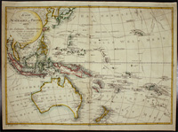
Streit’s map of Australia and the Pacific is executed with an excellent quality of engraving. Streit most likely takes inspiration from Swoboda and Hartls map of ‘Australien’ of 1805, as much of…[more]
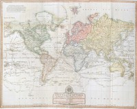
Covens and Mortier’s map of the world utilised a very popular style that was used during the 18th century. The beautiful cartouche shows four women that each represent a different region, Europe,…[more]
This early piece is the first printed map of Sydney Cove, which was made only 6 months after the first fleet arrived in Sydney.
The map focuses on the area of present day Circular Quay,…[more]
One of the few 18 th century maps concentrating on the Australian continent and showing the east coast joined from New Guinea to Tasmania .This piece comes from the Dutch edition which has both…[more]
One of Vaugondy's large folio maps. The Vaugondys were descended from the Nicolas Sanson family who were also map makers of some importance. From him they inherited much of Sanson's cartographic…[more]
One of the earliest polar maps of the Antarctic.
Of particular interest to historians is the suggestion in the text accompanying this map, which describes rather accurately the…[more]
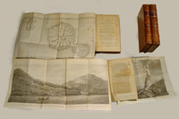
The third edition of Cook's famous voyage in which the East Coast of Australia and most of New Zealand was discovered and charted. There are 4 volumes in total in an octavo format. Unlike the…[more]
Lotter's map of the world in ovaloid projection showing the tracks of Cook's three voyages of discovery.
It is one of the first large scale maps to show the discoveries of Cook's three…[more]
Dawes map of the county of Cumberland in New South Wales is today better known as the Sydney region. The coast between Botany Bay in the south to Broken Bay in the north is shown, which extends…[more]
A large map of the world by Laurie & Whittle exhibiting all the quality of execution that they produced, especially in their large format maps. The design of the compass rose and cartouche are…[more]
Weigel & Schneider's map of Oceania and the Pacific was a popular depiction and format of the region for many german mapmakers. Their map shows the tracts of James Cook 1st, 2nd, and 3rd voyages,…[more]
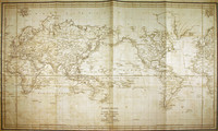
Map of the world showing the route of La Perouse's voyage. Cook's 1770 first voyage discoveries on Australia's East Coast are charted.
Following the immense success of Captain Cook's…[more]
Cooks map of the Southern Hemisphere after his second voyage. The map was the key chart of his second voyage, which was published in 1777. The map dispells the myth of the great southern land. It…[more]
A Collection of Voyages round the World; Performed by Royal Authority. Containing a complete Historical Account of Captain Cooks's First, Second, Third and Last Voyages, undertaken For making New…[more]
This chart by Hunter shows the coastline from Botany Bay to Broken Bay, including Port Jackson. The chart is very detailed and shows the depths to be found in each of the bays.
John…[more]
Up until 1627, the knowledge of Australian coastlines was restricted to largely haphazard contacts and sightings on the western and northern coasts. The eastern and southern coasts were completely…[more]
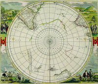
De Wits edition of this famous hemispherical map of the Antarctic region by Hondius. This edition shows the discoveries of Tasman in Australia and New Zealand .
Originally published by…[more]
‘New Holland and the adjacent Islands’, 1790 by Kincaid. The map depicts a very early inset map of Port Jackson and Sydney Cove. One of the earliest post settlement maps simply focusing on…[more]
A rare map of Norfolk Island drawn to accompany Majr. Barney's letter to the Hon.bl The Colonial Secy. Dated 20th Feby. 1840. Maps of the island are rare to find and especially pieces printed…[more]


.jpg)

.jpg)
.jpg)
.jpg)

.jpg)
.jpg)
.jpg)

.jpg)
.jpg)

.jpg)
.jpg)