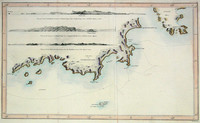
James Cook & William Bligh's map of part of the southern coast of Tasmania, formely Van Diemen's land. The charting was carried out during Cook's third voyage during which he was killed in Hawaii…[more]
Cook's famous folio atlas to his 3rd voyage containing 62 engravings including the rare Death of Cook plate plus two large charts showing the extent of Cook's exploration during his three voyages…[more]
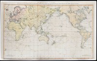
This map is the centrepiece to the Cook collection and is said to have been the most accurate map of the world on its publication in 1784.
The map was drawn up by Henry Roberts after work…[more]
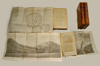
The third edition of Cook's famous voyage in which the East Coast of Australia and most of New Zealand was discovered and charted. There are 4 volumes in total in an octavo format. Unlike the…[more]
Bonne's map shows a number of islands in the Western South Pacific that were originally charted by Cook during his three voyages. The central focus are the islands of New Caledonia and the New…[more]
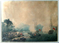
Cleveley's aquatint of the Death of Cook is among the best of the events depictions. In the fashion of aquatints at first glance it appears that the print is actually a watercolour.
…[more]
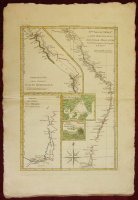
Bonne's map of Australia's east coast combines a number of James Cook's maps onto the one, in a kind of consolidation often used by Bonne. The map shows Australia's east coast, an inset of part of…[more]
Bowen's map of the Pacific is typical of the period. After the success of Cook's voyages in the 1770s the worlds attention was drawn to the Pacific where tales of paradise, danger, and adventure…[more]
A Collection of Voyages round the World; Performed by Royal Authority. Containing a complete Historical Account of Captain Cooks's First, Second, Third and Last Voyages, undertaken For making New…[more]
Cook and Roberts' world map was first published in 1784. This edition by Faden was updated to include new discoveries. One of the new discoveries inlcude the inclusion of Lord Howe Island,…[more]
This famous map by Hogg was printed to illustrate the discoveries of eighteenth century exploration in the Pacific. It displays Australia at an important aesthetic period only a few years before…[more]
"A Chart Shewing the tract of Capt Cook’s last voyage 1799", by Low. The map shows the route of Cook’s third voyage around the Pacific rim in search of the fabled Northwest passage. On the…[more]
Blackwood's map of the Southern Pacific is based on James Cook's 1773 chart of the same area. In this case the map was produced to be included in "Kerrs collection of voyages and travels". As…[more]




.jpg)
.jpg)
.jpg)
.jpg)
.jpg)
.jpg)