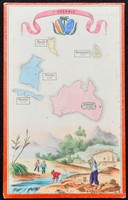
This interesting small map was most likely part of a board game or some other game or set. It shows several Pacific Islands and Australia. On each is marked the population of its major city/town.…[more]
This map displays a Celtic style border that provides a good frame for the map. This map is from a popular American atlas that would have been in many family homes and been a key note of reference…[more]
The famous map by Rapkin had been issued by Tallis since 1851. It had also included a number of vignettes surrounding the map including local animals, aboriginals and pictures of scenary. This…[more]
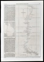
The expedition of Burke and Wills is one of Australia's most unfortunate. Robert Burke and William Wills left Melbourne on August 20 1860 with horses and camels brought from India. Together with…[more]
One of the first maps printed of the new colony of Queensland (1859). This very large map by Proeschel is very detailed and is canvas mounted, folding down into a booklet form.…[more]
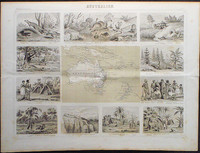
A heavily illustrated map of Australasia with many vignettes surrounding the map. The vignettes include scenes of the native population in Australia, New Zealand, and Pacific Islands including…[more]
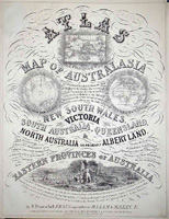
Evidence continues to imerge that points to Proeschel's atlas being the first national atlas to be printed in Australia. William Baker did publish 'The Australian County Atlas' in Sydney in 1843,…[more]
Map showing the Australian states very similar to how they are today. The map shows 68 counties in NSW. 38 in QLD, 24 in VIC, 14 in SA, and 26 in WA. Inset maps of both Tasmania and the…[more]
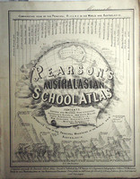
Pearson's rare school atlas is one of the first atlases printed in Australia. The atlas was printed in Melbourne in 1867 and is noted in the publishers' preference that other school atlases…[more]
Mitchell's exceptional map of New South Wales was first issued in 1834, being without doubt the most detailed accurate map of New South Wales up to that point. Interestingly this issue of the map…[more]
Towards the end of the 19th century and well into the 20th century many manufacturers produced trade cards as a collector orientated form of marketing. Most well known are cigarette cards though…[more]
Recently acquired impressive separately published map. Information to come.…[more]
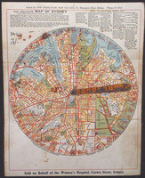
The indicator map of Sydney is a very interesting piece of pre-depression Sydney Ephemera. The early street finder is focused on central Sydney, 1.5 miles from Central Railway Station in all…[more]


.jpg)
.jpg)
![Western Australia [and] South Australia](/maps/thumb/1858 WA and SA (Weller).jpg)
.jpg)
.jpg)
.jpg)
.jpg)
.jpg)
.jpg)
.jpg)
.jpg)

.JPG)
