Printed from www.AntiqueMapart.com Catalogue on Thursday, Nov 21 2024
Search Criteria:


Showing Maps 21 to 40 of 220Jump to Page:Next12345 ... 1011Next
Western Australia, Swan River
1851
TALLIS, John
33 x 25 cm

Information to…[more]

India Orientalis
India Orientalis
1621
MAGINI, A, GALIGNANI
20 x 27 cm

The map focuses on Southern Asia and the Northern Pacific, also showing part of the west coast of North America. Part of northern Australia can be seen coloured in green at the bottom of the map.…[more]

Van Diemen's Island or Tasmania
1851
TALLIS, John
33 x 25 cm

Information to…[more]

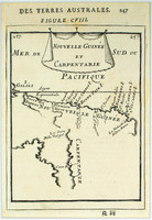
Nouvelle Guinee et Carpentarie
1683
MALLET, Alain-Manesson
12 x 15 cm

The first detailed published map to show any part of Queensland (Tully). Shows New Guinea , the east coast of Cape York Peninsula and part of Arnhem Land .

Although not a particularly…[more]

New South Wales
New South Wales
1851
TALLIS, John
33 x 25 cm

Information to…[more]

Victoria or Port Phillip
1851
TALLIS, John
33 x 25 cm

Tallis was best known for his very accurate and visually appealing maps and views, which included most of the countries and many of the colonies of the world at that time. His most accomplished…[more]

Australia
Australia
1847
HALL, Sidney
50 x 42 cm

By the late 1840s the extent of exploration of the Australian continent had expanded dramatically. This map illustrates many of the newly explored regions not seen on Johnstons 1844 map of…[more]

Part of South Australia
1851
TALLIS, John
33 x 25 cm

Information to…[more]

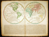
MappeMonde Historique
1809
LE SAGE
66 x 51 cm

Le Sage's map of the world is a good example of the movement towards the information age where information was key to the importance of a map and placing it into context rather than its decorative…[more]

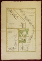
Nlle galles Merid.le ou Cote Orientale de la Nouvelle Hollande
1787
BONNE, Rigobert
22 x 33 cm

Bonne's map of Australia's east coast combines a number of James Cook's maps onto the one, in a kind of consolidation often used by Bonne. The map shows Australia's east coast, an inset of part of…[more]

Australien oder Polynesien
1796
SOTZMANN, D.F
32 x 26 cm

Sotzmann's map of the pacific is a popular German depiction of Australasia. Here Australia can be seen still connected to Tasmania as was believed until Flinder and Bass's discoveries in 1798…[more]

Isles De Salomon
Isles De Salomon
1683
MALLET, Alain-Manesson
12 x 15 cm

‘Isles de Salomon’, c1683 by Mallet. The map shows a number of ships exploring the Pacific. Interestingly the map hints at the possibility that New Zealand may be connected to the Solomon…[more]

A chart of the track of the Alexander on her homeward passage from Port Jackson on the eastn. coast of New South Wales to Batavia; performed in the year 1788 under the direction of Lieut.t John Shortland
1789
SHORTLAND, Thomas G.
35 x 26 cm

The Alexander was one of the eleven ships that made up the first fleet which settled the English in Australia in January 1788. The 450- ton convict transport ship transported around 200 convicts…[more]

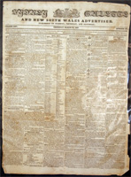
Sydney Gazette and New South Wales Advertiser, March 22nd 1827
1827
HOWE, Robert
40 x 54 cm
The Sydney Gazette was Australia's first newspaper, beginning operation in 1803. The paper was founded by George Howe whose son Robert would eventually take control of the paper in 1821. Initially…[more]
The Australian Colonies
1865
SDUK
70 x 39 cm

Map showing the Australian states very similar to how they are today. The map shows 68 counties in NSW. 38 in QLD, 24 in VIC, 14 in SA, and 26 in WA. Inset maps of both Tasmania and the…[more]

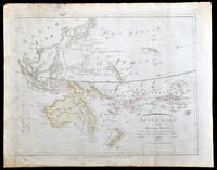
Australien oder die Insel Welt
1815
KIPFERLING, Karl Joseph
40 x 31 cm

Austrian map of the Australasian…[more]

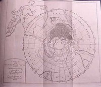
Chart of the Antarctic polar circle, with the countries adjoining...according to the new hypothesis of M. Buache..
1763
BUACHE, M
19 x 22 cm

A very interesting map of the southern hemisphere focusing on the southern pole and Australia. This is the English edition of Buache's map which theorizes on the shape of the Antartic landmass.…[more]

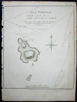
Isle Norfolk
Isle Norfolk
1778
COOK, James, BENARD
19 x 22 cm

The first map of Norfolk Island, which was discovered in 1774. The first edition of this map was included in James Cook's second voyages published in 1777. Because of Cook’s voyages wide…[more]

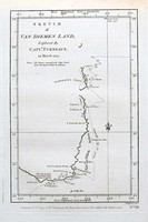
Sketch of Van Diemen’s Land
1777
FURNEAUX
14 x 22 cm

The first edition of the first separately printed English map to show part of the coast of Tasmania. Furneaux's track in the Adventure is shown.

In this English edition, this is the…[more]

A chart of the track of the Scarborough on her homeward passage from Port Jackson on the Et. (East) coast of New South Wales towards China
1789
MARSHALL, Captain John
24 x 42 cm

The Scarborough was one of the ships of the First Fleet, which brought the English to Sydney in January 1788, where they would establish the first English settlement.

, .

This chart shows…[more]