This interesting map by Aaron Arrowsmith highlights the fact that in 1802 there was little accurate knowledge of the coastlines of the southern portion of the Australian continent. It does…[more]
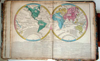
The English edition of Le Sage's impressive French folio atlas. This is the second English edition and is updated until 1818. Its title page notes "Second Edition improved with a new Geographical…[more]
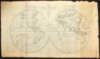
This map of the world is believed to have been engraved by Herman Moll circa 1700. After this edition there were a number of adaptations of the plate including one example in the National Library…[more]
This famous map by Hogg was printed to illustrate the discoveries of eighteenth century exploration in the Pacific. It displays Australia at an important aesthetic period only a few years before…[more]
This chart is the first of the beautiful world heritage Australian Island of Lord Howe. Lord Howe was discovered by Ball on his journey to set up a second English settlement on Norfolk Island. The…[more]
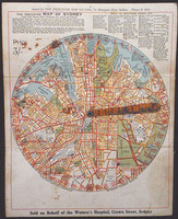
The indicator map of Sydney is a very interesting piece of pre-depression Sydney Ephemera. The early street finder is focused on central Sydney, 1.5 miles from Central Railway Station in all…[more]
An interesting map of the world, showing discoveries up until 1793. It can be presumed that the map was printed circa 1795. However it is most likely that the map was originally printed in the…[more]
A very detailed and finely engraved map of the major newly colonised parts of south-eastern Australia, with insets showing Western Australia, Van Diemen's Land and plans of Sydney and Adelaide. …[more]
A reduced version of Dalrymple's chart, this map shows the tracks of many explorers including Tasman, Schouten, Mendana, Quiros, Torres and Roggevin. Of particular interest is the track of Torres,…[more]
This map charts the voyage of William Bligh after he was set adrift during the mutiny on the Bounty in 1789 and sailed over 6000kms from Tofoa (Tonga) to Bativa (Indonesia). During his voyage he…[more]
The first depiction of any part of Australia 's east coast based on actual observation. This map shows the tracks of Bougainville 's ships the Boudeuse and L'Etoile around the world in 1766 - 1769…[more]
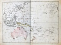
Walch's map of the Pacific comes after most of the major coastal charting of the region has been made though of course in the case of Australia a vast majority of the interior is still unexplored…[more]
This early plan of Norfolk by William Bradley shows in some detail the depth soundings around the island. Though the plan does not show much of the Islands interior it does mark the location of…[more]
This is the first French edition of the first published chart of the east coast of Australia . As was often the case at the time and because of the popularity and importance of Cook's discoveries…[more]
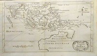
First printed in the 1670s this map was so popular that it was printed up until the mid 1700s. This edition of the map comes from a Dutch bible circa 1736.
Interestingly the map displays…[more]
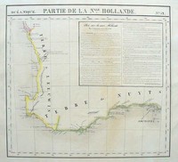
Vandermaelen's map of south western Western Australia encompasses the coastline between Jurien Bay to Cape Le Grand and is listed as Plate number 52 from the Atlas Universal. On the map is an…[more]
The first published chart of Botany Bay and the Endeavour River after the original drawing by Cook himself and published in the official account of Cook's first voyage.
This map was…[more]
Dampier, a reformed pirate, published an account of his buccaneering voyages in 1698, gaining himself a better reputation. Dampier travelled to Australia on two occasions, once in 1688 on Read's…[more]
Another very important chart in terms of the English settlement of Australia. This chart was completed by John Hunter shortly after establishing the settlement in Sydney cove in 1788. The First…[more]



.jpg)
.jpg)
.jpg)

.jpg)

.jpg)
.jpg)


.jpg)
.jpg)