Printed from www.AntiqueMapart.com Catalogue on Thursday, Jan 23 2025
Search Criteria:


Showing Maps 181 to 200 of 245Jump to Page:Next12 ... 8910111213Next
A Chart of New South Wales, Van Diemen's Land, & C.
1821
ASPIN, J.
60 x 50 cm

Aspin's chart shows inset maps of Tasmania, the settlements at Port Jakson and Patterson's river, and of the Australian continent, marked 'New Holland'.

A very nice map showing the…[more]

Lavoisne's Complete Genealogical, Historical, Chronological, and Geographical Atlas…
1822
LAVOISNE
30 x 45 cm

information to…[more]

Map of Van Diemans Land; Map of part of New South Wales
1824
LIZARS, Daniel
50 x 35 cm

Two maps by Lizars on the one sheet. One focuses on Van Diemens Land (Tasmania) and the limit of interior exploratioin, most notably connecting the northern and southern coastlines. There is also…[more]

Carte de L'Australie
1826
BRUE, Adrian
51 x 36 cm

Brue had a special relationship with Australia. He was involved in Baudin's expedition between 1801 and 1803 which charted the Australian coastline. The discoveries from the expedition would…[more]

Sydney Gazette and New South Wales Advertiser, March 22nd 1827
1827
HOWE, Robert
40 x 54 cm
The Sydney Gazette was Australia's first newspaper, beginning operation in 1803. The paper was founded by George Howe whose son Robert would eventually take control of the paper in 1821. Initially…[more]
Sydney Gazette and New South Wales Advertiser, March 31st 1827
1827
HOWE, Robert
40 x 54 cm
The Sydney Gazette was Australia's first newspaper, beginning operation in 1803. The paper was founded by George Howe whose son Robert would eventually take control of the paper in 1821. Initially…[more]
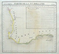
Oceanique. Partie de la Nlle Hollande (Western Australia)
1827
VANDERMAELEN, Philippe
40 x 43 cm

Vandermaelen's map of south western Western Australia encompasses the coastline between Jurien Bay to Cape Le Grand and is listed as Plate number 52 from the Atlas Universal. On the map is an…[more]

Chart of part of New South Wales, with plans of the harbours...respectfully dedicated to John Oxley...
1829
CROSS, Joseph
93 x 61 cm

Joseph Cross' map of New South Wales is one of the earliest detailed and most comprehensive of interior New South Wales. It was originally issued in 1826 and at that time also had a decorative…[more]

THE FRIEND OF AUSTRALIA; or, A Plan for Exploring the Interior, and for Carrying on a Survey of the Whole Continent of Australia...
 THE FRIEND OF AUSTRALIA; or, A Plan for Exploring the Interior, and for Carrying on a Survey of the Whole Continent of Australia...
1830
MASLEN, Thomas J
21 x 14 cm

A very rare and desirable book on a plan to explore the interior of Australia by a retired officer. More information to come.…[more]

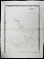
Carte de la Partie Septentrionale De La Nouvelle Zelande
1831
DUMONT D'URVILLE, Jules
43 x 58 cm

Durville's chart shows the track of his 1827 voyage in the Astrolabe (named in memory of La Perouse's flagship) during their scientific expedition to the region. The map is a significant…[more]

Carte generale de la partie de la Nouvelle Zelande, reconnue par le Capitaine de Fregate Dumont D’Urville
 Carte generale de la partie de la Nouvelle Zelande, reconnue par le Capitaine de Fregate Dumont D’Urville
1833
DUMONT D'URVILLE, Jules
40 x 55 cm

Information to…[more]

Van Diemens Land
Van Diemens Land
1834
ARROWSMITH, John
54 x 66 cm

Arrowsmith's map of Van Diemens land or Tasmania is a legacy of the high quality work that John Arrowsmith produced. He worked on a number of maps and charts during a vital age of Australian…[more]

British Possessions in Africa and Australasia
1835
COCHRANE, WALKER
92 x 32 cm

The map depicts the region between South Africa and Australia, focusing on the extent of possessed lands. It is resonably detailed and has inset lists of the total of Britains land holdings in the…[more]

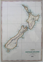
Carte de la Nouvelle-Zelande…
1835
DUMONT D'URVILLE, Jules

‘Carte de la NouvelleZelande’, 1835 by D’Urville. The map shows New Zealand as charted by D’Urville in 1835. The map corrected some of the mistakes made by Cook during his charting of NZ in…[more]

Mappemonde
Mappemonde
1836
MALTE-BRUN, Conrad
48 x 27 cm
Information to…[more]
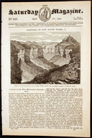
The Saturday Magazine, May 7th 1836: Sketches of New South Wales I
1836
PARKER, John William
18 x 28 cm

The Saturday Magazine was issued by the Committee of General Literature and Education, who were supported by the Society for Promoting Christian Knowledge. At this this time the expansion of the…[more]

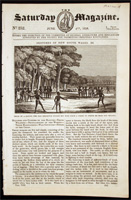
The Saturday Magazine, June 4th 1836: Sketches of New South Wales. III
1836
PARKER, John William
18 x 28 cm

The Saturday Magazine was issued by the Committee of General Literature and Education, who were supported by the Society for Promoting Christian Knowledge. At this this time the expansion of the…[more]

The Saturday Magazine, May 28th 1836: Sketches of New South II
1836
PARKER, John William
18 x 28 cm

The Saturday Magazine was issued by the Committee of General Literature and Education, who were supported by the Society for Promoting Christian Knowledge. At this this time the expansion of the…[more]

A Chart of Part of New South Wales, Van Diemens Land, New Zealand and Adjacent Islands, with the principal harbours
1837
NORIE, John William
93 x 64 cm

The large sea chart by Norie details the region between the southern part of Australia and New Zealand. At this time New Zealand was beginning to be colonised and this chart was most likely…[more]

Three Expeditions into the Interior of Eastern Australia, with Descriptions of Australia Felix, and the Present Colony of New South Wales
1838
MITCHELL, Major Thomas Livingstone
14 x 22 cm

Major Thomas Livingstone Mitchell was a man that was both successful with his exploration and surveying and also criticised for some of his methods. He was the Surveyor General after Oxley and…[more]